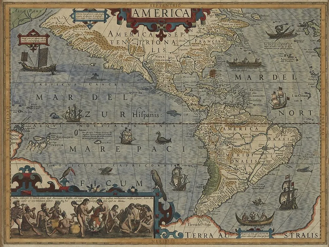
Jodocus Hondius (1563-1612), “America,” Amsterdam, 1606. Hand colored map of North and South America from Hondius’ first edition of the Mercator atlas. This map is profusely decorated: the sea abounds with sea monsters and ships, many representing the traditional vessels of the areas near which they are sailing. An elaborate strapwork cartouche along the lower left depicts a group of native Brazilians brewing caium, a traditional alcoholic beverage. Other notable features of this map include the depiction of Tierra del Fuego as part of the mythical continent of “Terra Australis,” and an unusual projection of Virginia, extending far into the Atlantic Ocean.
Sight: height: 15 in x width: 20 in.
Framed: height: 16 1/8 in x width: 21 1/8 in.
$2,800
